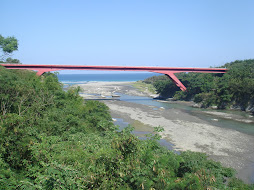
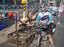
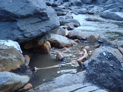
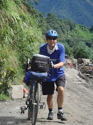
Our trip began at Sun Moon Lake at a height of about 800m. A civilized start to the day meant that we had time to enjoy the views across the lake before climbing on the bikes. We began gently, following Route 21 as it wound its way southwards, gradually losing height, so that by the time we were on the outskirts of Shueili, we were down to 400m. At this point the road divided. Although our route lay straight ahead, we turned right to enter Shueli town itself. This meant descending a further 100m, but it was a good decision as there were an abundance of places to have an early lunch meal and pick up supplies. In fact, Shueili is a fair-sized town and well worth looking around. After eating our fill, we climbed back out of the town and joined Route 21 again. For most of the rest of the day the road climbed gently - almost imperceptibly. We rode through wide valleys and over rivers, fairly tame when we saw them, but which can turn into raging torrents when a typhoon hits. We also saw the old road hugging the valley wall, destroyed by the 2001 earthquake (?) and now abandoned. By late afternoon we reached the Dung Pu turn-off. Thus far it had been a pleasantly laid-back kind of day with nothing too strenuous. However, there was a sting in the tail. Between us and our overnight stop at the village of Dung Pu lay a stiff 400 meter climb. When you spend most of the day sauntering along, it's surprising how tough a short ascent can be and by the time we reached the cobbles of Dungpu main street, our muscles and lungs were crying out. Fortunately, this popular resort, lying at over 1100m, had the perfect antidote - natural hot springs. So, after quickly setting up camp, we rushed off to soak in the soothing waters. As an added bonus, on our way back to the camp we ran into a display of aboriginal dancing being performed in the lobby of a local hotel. A perfect end to the day.
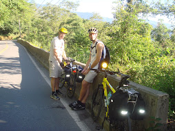
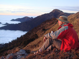
On Day 2 we were up at the crack of dawn, eager to take full advantage of the good weather. It would be a long day and mountain weather is unpredictable. Breakfast was a large helping of dumplings with a kind of Taiwanese omelette. Not exactly health food, but exactly the fare necessary for the ride ahead. After all, today was the big climb up to Tatajia - a continuous ascent of almost 2000 meters. The ride started easily enough with a plunge back down the valley from Dung Pu to the town below. We felt a tinge of regret at having to lose so much height, but this was more than offset by the stunning early morning views across the valley and the sheer exhiliration of the descent. The small town at the foot of the hill was the last opportunity to pick up food and water. Ahead lay 30-odd kilometers of unspoilt scenery. Despite being the only road connection to Chiayi, Route 21 is almost traffic-free and the only sound was the whirring of wheels and, in my case, the gasping of lungs! The heat of the valley below was soon left behind and it became pleasantly cool. The vegetation changed, too, becoming thicker and more lush. At one point, a Marten ran across the road in front of me, stopped briefly to look me up and down, and then disappeared into the forest. Where the road opened out, we were able to look back across the valley to our home of the previous night, Dungpu, and witness the sun burning off the last of the morning mist in the valley bottom. We stopped a number of times on the ascent, sometimes to make sure that nobody had been dropped or was having mechanical problems, sometimes just to catch our breath and enjoy the views. And of course, every break involved eating and drinking! And so the hours passed. Route 21 could best be described as a steady climb, without too many horrendously steep grades, although, as with many mountain roads, it does get steeper toward the summit. It was really a question of finding a comfortable low gear and sticking to it. I don't think I made more than half a dozen gear shifts the whole way up. A little after 2:00 in the afternoon, we reached the "husband and wife trees". This is a pair of oddly shaped trees just off the road to the right. It was a great place to stop, not only because it made a good picture, with the swirling mist all around, but also because the trees are located just three or four kilometers from the top and the break gave us the energy to finish the climb with a flourish. Finally we had made it - my longest ever single day climb! The National Park center at the top is the starting point for hikes up Jade Mountain, Taiwan's highest peak, and has an interesting introduction to the surrounding area. Upstairs is a simple cafe selling, among other things, refreshing hot sweet tea. We spent about an hour at the top before the darkening clouds hastened us back to the bikes. The descent from Tatajia went by in a blur, but I remember it being steep and fast. After perhaps 20 minutes we came to a fork in the road. A right turn led to Ali Mountain, one of Taiwan's premier tourist destinations. Sadly, we didn't have time to visit on this trip, and our road lay ahead, so on we went. It was still downhill from here, but a little gentler, with more time to take in the scenery. Spots of rain began to fall, but our target for the night was not far ahead. Finally, there it was, Shr Dz Lu, meaning crossroads, built at the point where the road meets the famous AliShan railway. Tired, but happy, we emptied the local grocery store, filled our stomachs, and hit the sack.
On the third and final day of our trip we just had a short ride from Shr Dz Lu to Chai Yi train station. Fortunately, the weather had cleared up and the ride was mostly downhill. Altogether a very enjoyable and memorable trip on 'the beautiful machine'
Martin (UK)
Subscribe to:
Post Comments (Atom)

No comments:
Post a Comment